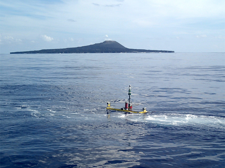
Since the Kobe Ocean Bottom Exploration Center (KOBEC) was established in 2015, the Center has carried out three survey voyages to the Kikai Caldera, south of Japan’s main islands. Based on these voyages, researchers have confirmed that a giant lava dome was formed after the underwater volcano erupted 7300 years ago. The dome is in the world’s largest class of caldera, with a volume of over 32 cubic kilometers. The contents of this lava dome is different from the magma that caused the giant caldera to erupt – it shows the same chemical characteristics as the current post-caldera volcano on the nearby Satsuma Iwo-jima Island. It is possible that currently a giant magma buildup may exist under the Kikai Caldera.
The survey voyages used training ship Fukae Maru, part of the Kobe University Graduate School of Maritime Sciences. These findings were published in the online edition of Scientific Reports on February 9.
There is roughly a 1% chance of a giant caldera eruption occurring within the Japanese archipelago during the next 100 years. An eruption like this would see over 40 cubic kilometers of magma released in one burst, causing enormous damage. The mechanism behind this and how to predict this event are urgent questions.
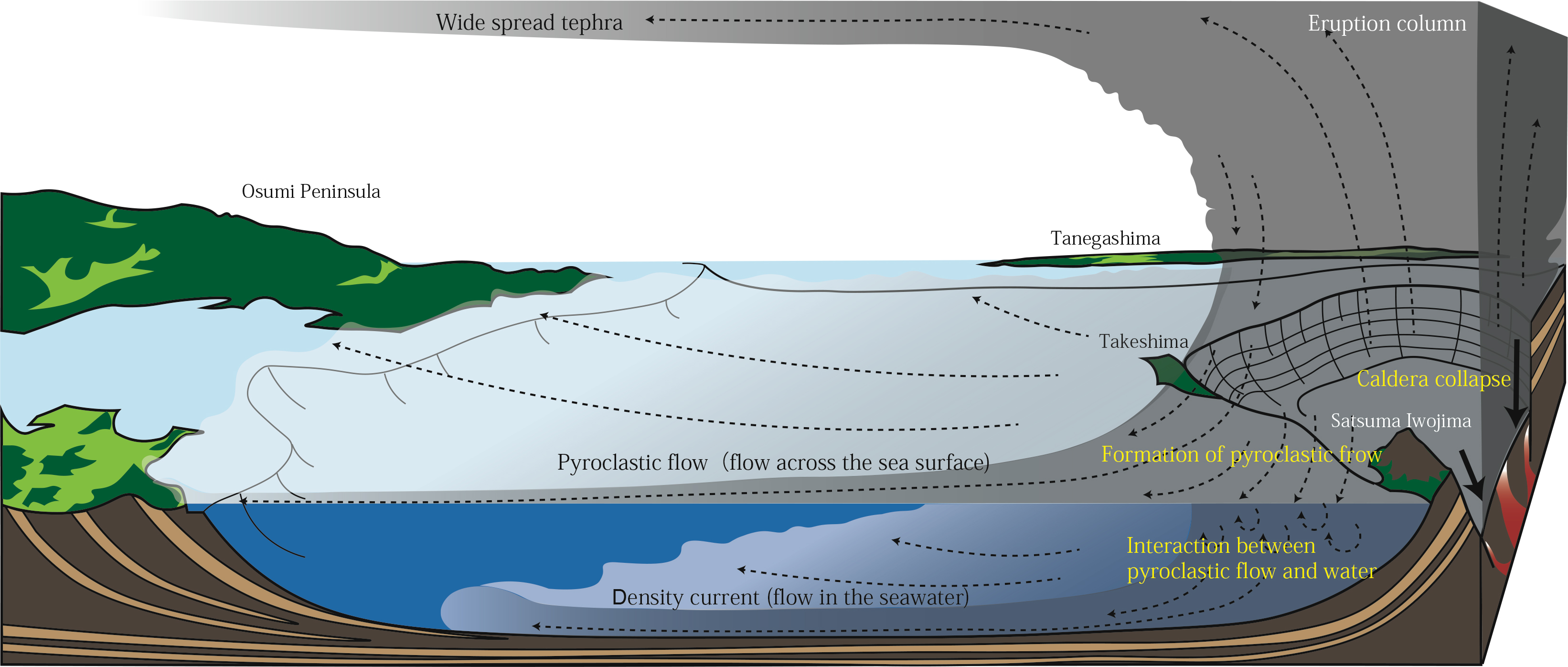
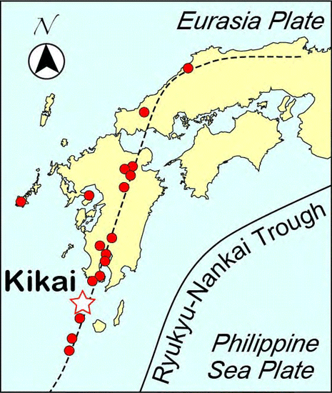
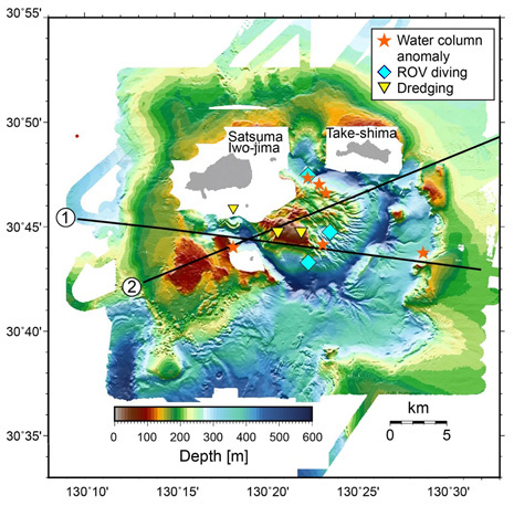
Researchers equipped training ship Fukae Maru with the latest observation equipment to survey the Kikai Caldera. They chose this volcano for two main reasons. Firstly, for land-based volcanoes it is hard to carry out large-scale observations using artificial earthquakes because of the population density, and it is also difficult to detect giant magma buildups with precise visualization because they are often at relatively low depths (roughly 10km). Secondly, the Kikai Caldera caused the most recent giant caldera eruption in the Japanese archipelago (7300 years ago), and there is a high possibility that a large buildup of magma may exist inside it.
During the three survey voyages, KOBEC carried out detailed underwater geological surveys, seismic reflection, observations by underwater robots, samples and analysis of rocks and stones, and observations using underwater seismographs and potentiometers.
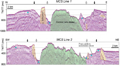
In their upcoming March 2018 voyage, researchers plan to use seismic reflection and underwater robots to clarify the formation process of the two-layer caldera revealed in previous surveys and the mechanism that causes a giant caldera eruption.
They will also use seismic and electromagnetic methods to determine the existence of a giant magma buildup, and in collaboration with the Japan Agency for Marine-Earth Science and Technology will carry out a large-scale underground survey, attempting to capture high-resolution visualizations of the magma system beneath the Earth’s crust (at a depth of approximately 30km). Based on results from these surveys, the team plans to continue monitoring and aims to pioneer a method for predicting giant caldera eruptions.
Formation of metallic ore deposits are predicted to accompany the underwater hydrothermal activity, so the team also plan to evaluate these undersea resources.
Technical terms
- 1. Caldera
- a depression in the land formed when a volcano erupts
- 2. Giant caldera eruption
- an eruption that releases a large amount of magma (>40km3) and forms a large-scale caldera. This sort of eruption has occurred ten times on the Japanese archipelago in the last 120,000 years. Giant caldera volcanoes are concentrated in Kyushu and Hokkaido.
- 3. Seismic reflection survey
- Causing an artificial earthquake with air guns or similar, receiving the seismic waves that have reflected or refracted below ground, and estimating the subsurface structure.
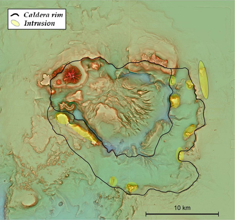
The caldera and the lava dome can clearly be seen.
We can see the lava dome, the caldera rim layers, and intrusions along the rims.
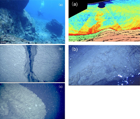
(Left) Figure 5. Surface of the lava dome
Images show distinctive cracks in the surface of the lava dome formed underwater, and (c) is a pillow-lobe structure. (a) courtesy of NHK.
(Right) Figure 6.
A water column anomaly (the red plume in “a”) and gas released (b), observed at the lava dome by a remotely-operated vehicle
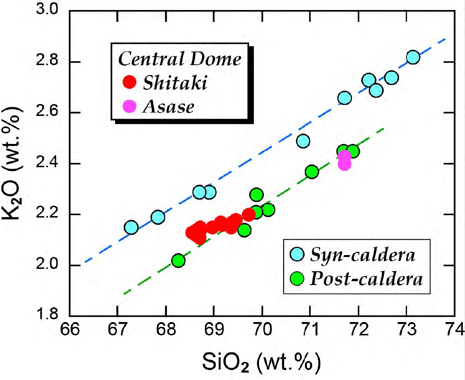
Different from the eruptions in the large-scale pyroclastic flow when the caldera was formed, it shows the same characteristics as post-caldera rocks (such as Satsuma Iwo-jima)
Journal information
- Title
- “Giant rhyolite lava dome formation after 7.3 ka supereruption at Kikai caldera, SW Japan”
- DOI
- 10.1038/s41598-018-21066-w
- Authors
- Yoshiyuki Tatsumi1, Keiko Suzuki-Kamata1, Tetsuo Matsuno1, Hiroshi Ichihara1,2,Nobukazu Seama1,3, Koji Kiyosugi1,4, Reina Nakaoka1, Kazuo Nakahigashi1,5, Hideaki Takizawa6, Kazuki Hayashi3, Tatsuro Chiba7, Satoshi Shimizu1,8, Mamoru Sano1,8, Hikaru Iwamaru1,8, Haruhisa Morozumi1,9, Hiroko Sugioka1,3, and Yojiro Yamamoto10
1 Kobe Ocean-Bottom Exploration Center, Kobe University, Japan
2 Earthquake and Volcano Research Center, Graduate School of Environmental Studies, Nagoya University, Japan
3 Department of Planetology, Kobe University, Japan
4 Organization of Advanced Science and Technology, Kobe University, Japan
5 Department of Marine Resources and Energy, Tokyo University of Marine Science and Technology, Japan
6 Johnny & Associates, Japan
7 Asia Air Survey, Japan
8 Nippon Marine Enterprises, Japan
9 Japan Oil, Gas and Metals National Corporation, Japan
10 Japan Agency for Marine-Earth Science and Technology, Japans - Journal
- Scientific Reports (Nature Publishing Group)